| CAI Pesaro | |
| CAI Montefeltro | |
| CAI Rimini | |
 |
CAI Ancona |
 |
CAI Fabriano |
 |
Lupus in Fabula |
 |
Camminando Monti e Valli |
 |
La Cordata |
| Il Ponticello |
Author: Lucio
Weekly Treks Proposals (old)
| CAI Pesaro December 15 Monte Schioppettino CANCELLED |
|
| CAI Rimini December 18 Mondaino-Montespino |
|
 |
Lupus in Fabula December 18 Cesane |
 |
Camminando Monti e Valli December 18 Monte Cucco |
 |
La Cordata December 18 Monte Catria |
| Il Ponticello December 18 Cesane |
The Sorcerer of the Carda
When walking through the beautiful trails on the Western side of Mount Nerone, passing by Rio Vitoschio, Ca Rossara, Fosso del Mulino (Mill Ditch) and Mount Cardamagna, I have always been intrigued and fascinated by “The Carda”. Many times I wondered for instance if the origin of the name itself, spread and used in quite a large area around the Pian di Trebbio pass, came from the water stream, the mountain itself or from the family who owned these lands and its ancient castle. The toponym, as Luigi Michelini Tocci (one of the most productive local historians ever) says, actually comes from “cardo” (thistle), one of the most common plants in the surroundings, while “the Carda” is the name of the area enclosed between the two easily recognizable mountain ridges. The highest one belongs to Mount Cardamagna and tops over 900 meters, representing almost a defensive stronghold for Mount Nerone, while the other one (called “La Cardaccia”) is 200 meters lower and was once hosting the Castle. In front of the ridges, across the road connecting Piobbico and Pianello with Pian di Trebbio, the Carda is clearly delimited by the mounts of Serra della Stretta, which holds the little village of Acquapartita on the opposite side.
The Castle of Carda was located right above Fosso del Mulino and San Cristoforo di Carda, but unfortunately today we just have a few ruins left, scattered on the mountain slope. It belonged to the Brancaleoni, the most powerful Piobbico family, since the XII century (even if most probably it was built much earlier), later became property of the Bishop of Città di Castello and at the end of the XIII century it was given as a gift to the famous Cardinal Ottaviano Degli Ubaldini, damned in the Epicureans circle in Dante’s Inferno together with Emperor Frederick II, whom he apparently supported. Ottaviano was in fact considered heretical because his family belonged to the Ghibelline party and this was sufficient at the time to deserve burning in Hell’s fire for eternity, even if the facts would demonstrate that he was actually leading the Guelph army from Bologna against the Emperor and that the Pope himself appointed him to conquer back the Church lands in the Po river valley. In any case Ottaviano was probably the first famous member of the family that was to become in control of the Apecchio area, the Ubaldini, coming originally from Mugello in Tuscany and then, through continuous wars and alliances, reaching the present Province of Pesaro and Urbino. Ottaviano gave the castle to his grandnephew Tano, who became the ancestor of the local branch of the family, the Ubaldini della Carda.
From the Carda the family spread out conquering other castles in the area, and Montevicino, Apecchio, Pietragialla and Castelguelfo fell soon under their Dominion. But the move that most of all sanctioned their fortune was to become allied and “war partners” with the powerful Montefeltro family, providing the Dukes of Urbino with troops and military knowledge in many conflicts throughout Italy. The Ubaldini family was in fact renown for being a forge of commanders and among its military masters one of the most famous representatives was Giovanni Ubaldini, who was capable in the XIII century to found his own “company of fortune”, with over a thousand soldiers and two thousand horsemen coming from all over Europe.
Bernardino degli Ubaldini was born at the end of XIV century, probably in the Carda, and he was maybe one of the most celebrated captains of his age, gaining the nickname of Magnifico (The Magnificent). His pronounced abilities as a war leader made him become very close to the Duke of Urbino, Guidantonio, who wanted him as a partner, and his value and strategic importance grew bigger with time until he was honoured with becoming a family member by marrying Guidantonio’s daughter Aura in 1420.
Bernardino definitely had a natural son, called Ottaviano like his forefather, but according to what in the past seemed to be nothing more than a rumor that later revealed itself as more than truthful, he was as well the father of Federico, the most acclaimed among all Dukes of Montefeltro. Until not long ago it seemed certain that Federico was born from an affair Guidubaldo had with one of the court’s ladies, and for this reason he was considered illegitimate. He was then given in custody very soon to a family in Mercatello, and later at the age of eleven he was sent to Venice apparently not only as a pledge of peace according to the customs of the time, but also to accommodate the will of Guidantonio’s second wife, who was not very happy to have him around in Urbino.
Several studies were carried on regarding Federico and his birth, but the recent publications (1) from the Apecchio historians Lionello Bei and Stefano Cristini are worth mentioning, as well as the articles by the same authors published on the VERSACRUM local history blog. As it also appears from their researches the argument is today much more debated comparing to the seemingly solid truth of the past, and we can even come to the conclusion that Federico was indeed son of Bernardino Ubaldini Della Carda, and that his natural father was so much committed to Guidantonio (who was not succeeding in having a male successor and therefore in granting stability to the State) to give away his first born son, making him at all effects a Montefeltro.
Ottaviano Ubaldini Della Carda was born in 1424, two years after his brother, and followed his fate, being sent very soon away from home to the Visconti Dukes of Milan again as a pledge for the peace reached between the two families.
As noted by Michelini Tocci the two boys, either they were brothers or not and despite the long periods of time they were apart, became great friends as their “official” fathers also were, and remained attached to each other for the rest of their lives.
In 1437 Bernardino Della Carda died, leaving as legitimate heir of all his possessions Ottaviano, but he decided also to split equally his army between Ottaviano and Federico, proving his strong tie towards both of the two young men. But Ottaviano was more keen on books, leading the troops into battle was too big of a burden to him and so he decided to leave the complete command to Federico, who found himself very young in charge of eight hundred spears.
Federico was a natural born leader, with exceptional strength and endurance and by heading his army at the service of the highest bidder he gained more and more public exposure thanks to his continuous victories. In 1441 took place maybe his most intrepid action ever, when he was able to take San Leo from the Malatesta family, climbing with a handful of men the steep cliff, taking the fortress and becoming in this way a celebrity all over Italy.
Despite his success he could not though claim to himself the Dukedom of Urbino, since in the meantime was born the legitimate son of Guidantonio, Oddantonio, who became Duke when his father died in 1443.
Everything seemed to fall into place following the most logical scheme of things, with Urbino having granted the blood succession and consequently its political stability and with Federico continuing the life he loved most as a soldier. But not even one year after being invested, Oddantonio was assassinated after the famous conspiracy plotted by his closest counsellors, shuffling cards once again. Federico was fighting in Pesaro when he was urgently summoned back home and declared Duke by the overwhelming pressure of the people, despite the insisting rumours (even though coming mostly from the rivals Malatesta) pointing at him as the mastermind behind the plot.
Starting from his investiture as the new Duke, Urbino will have his best period in all history, thanks not only to his military skills but also (and maybe above all) to the political and administrative abilities of his “brother”, who had been almost forgotten in his exile in Milan.
Ottaviano was a very smart guy, serious and with uncommon good sense, self control and stern and almost mystical severity, and within a few years he had been able to become (although he was still considered as a hostage) very dear to the Duke Filippo Maria Visconti and to represent an important figure in the court of Milan, as the time chronicles tell us.
Great academic, he was able to have access to huge libraries and to have some of the most eminent and erudite men of his time as teachers. In those days among all sciences astrology was having a very important role especially within the palaces. It seems like the Duke of Milan did not want to move a finger without consulting with his astrologers first and as a consequence Ottaviano himself was hit by a quite deep and specific “magic” education.
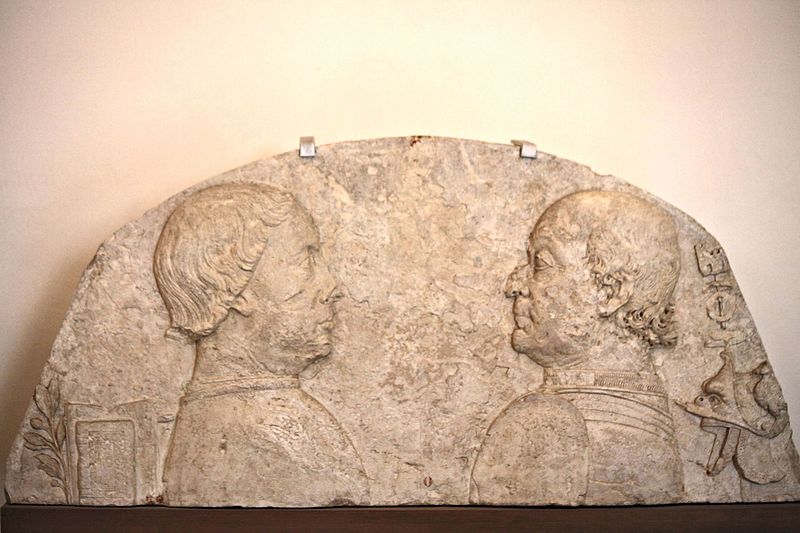
Ottaviano remained in Milan until the death of Duke Visconti, in 1447, then he returned to his beloved and never forgotten Carda, and to Urbino, where Federico called him to share the government of the State. Thirty five years of cooperation with the Duke will follow, forming in fact a diarchy that was one of the most enlightened and efficient government systems of the time. Federico took care of the war matters and contributed to the biggest part of the Urbino income with his military services sold all over Italy, while Ottaviano was the real ruler and his accurate and forward-thinking management made the ducal city one of the most important centers for the Humanistic culture and the Renaissance arts, creating also a true political reference point for all Europe. Ottaviano, together also with Federico, continued to be involved with astrology and the importance of this science was so big at the court of Urbino that after the building of the Ducal Palace (Palazzo Ducale) the front towers (Torricini) became observatories and home to the many other astrologers called in the city to share their knowledge. This is to many the best time for the Duchy, enriched by the presence of Laurana and Francesco di Giorgio Martini, with the latter depicting the engine of the enthusiasm impregnating the whole State in the famous marble lunette showing Federico close to a military sign and Ottaviano with two books and an olive twig.
The two rulers did not forget about their origins and the Carda. Federico built a hunting residence in the village of Colombara, and one of the buildings still present today near S.Cristoforo is attributed to the great architect Francesco di Giorgio.
The enchanted period came to an end with the death of the Duke in 1482, during one of his countless military campaigns.
Ottaviano continued to administer the State even after the power went to Federico’s son, Guidubaldo, arranging his wedding with the pupil of another powerful Italian family, Elisabetta Gonzaga. At this point of time his meticulous work as an alchemist and astrologer pushed him a bit too far with the interpretation of the heavenly signs, since he asked the two newlyweds to wait for the most favourable time before consummating their union. Unfortunately the stars alignment was not propitious and the right time never arrived. As the days passed the information leaked out and spread into the city, making the wait of the court the one of the entire Duchy and adding even more pressure on the two spouses. Guidubaldo particularly suffered from neurosis that got worse and worse during that time, and resulted in a deep crisis that did not allow the marriage to be ever consummated, making him by fact the last member of the Montefeltro dynasty.
The Sorcerer of the Carda was accused of witchcraft and of “putting up the show” just to keep the power for himself, making the last decade of his life a dark period, not worthy of his absolute greatness as a statesman, but despite all he continued to hold the reins of the government of the Duchy until his death in 1498.
He was laid to rest in the church of St. Francis in Cagli, where anyhow his burial place was never clearly identified, as if even after being dead he had to remain in the shade as he had done throughout his life.
But the Sorcerer of the Carda was so bound to his homeland that it seems almost impossible he did not want to remain close to it through eternity, and in fact rumors continue to spread whispering he is still roaming around the ruins of the Cardaccia and in the Gamberaia Gorge and maybe even today, when wandering on the trails of the western side of Mount Nerone, someone can still feel his presence.
Based on “Storia di un mago e di cento castelli” by Luigi Michelini Tocci
Lucio Magi © 2016
(1)
“La doppia anima. La vera storia di Ottaviano Ubaldini e Federico da Montefeltro” Bei-Cristini
“Vita e gesta del magnifico Bernardino Ubaldini della Carda” Bei-Cristini
http://versacrumricerche.blogspot.it/p/la-vera-paternita-di-federico-da.html
http://versacrumricerche.blogspot.it/p/via-e-gesta-del-magnifico-bernardino.html
(2)
Image from Wikimedia Commons
Sasso Simone – The City of the Sun
While preparing for the next trek inside the Sasso Simone and Simoncello Regional Natural Park here is a short article on the Città del Sasso or Città del Sole (City of the Sun), with the only intent to refresh the common memory and inviting everyone who wants to dive deeper into the subject to use the many sources of information available.
We are in 1566 and on top of the Sasso Simone plateau we can attend to a very special beginning of “construction works”. At that time the Sasso Simone and Simoncello are included into the Tuscany Grand Duchy, right on the borders with the Montefeltro ruled by the rivals Dukes of Urbino, and Cosimo de Medici (the ruler of Tuscany) is inaugurating a project considered absurd by many, build a real city right on top of the bigger Sasso .
I will try here to get back to the origins of such idea, but in order to do that I will need to take a digression back to the history of Italy in 1500, promising to simplify as much as I can the very complex chronicle of the events.
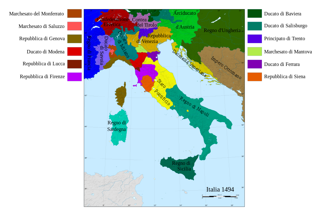
Italy was not in the middle of a quiet period, fragmentation and confusion were ruling on all the peninsula brought by the passage from the Middle Ages to the Modern era. In the North Milan, Venice and Florence were the strongest powers. In the South, possibly the most stable area, the Kingdoms of Sicily and Naples were united under the Aragones, while some of the Maritime Republics were still holding the power at sea. The Pope had control on most of the Center, but still many areas were in fact ruled by local lords.
In this scenario explode the so called “wars of Italy”, with Spain and France as protagonists and antagonists. The two rival countries battle for the supremacy in Europe for over seventy years right on Italian ground, transforming it by fact in a battlefield at the mercy of the two contenders, and bringing destruction and plunder all over.
Charles VIII of France is the first to invade Italy in 1494 traveling through the ancient Via Francigena and meaning to seize the Kingdom of Naples since he considered himself in some way its legitimate heir for his lineage from the Anjou family.
The French King conquers Naples with the help of Pope Alexander VI Borgia, who is forced to allow him to pass through the Church territories but is also sending his son Cesare, who will become an important figure in the coming years, along with him as a guide. The French predominance does not last long and the troops are forced to go back North through Italy pushed by the power of the league made of Milan, the Papal State and Venice, merging forces also with Spain and Austria.
Louis XII succeeds Charles VIII and gets from him his mania of grandeur, thinking he also has inherited rights on another piece of Italy (this time the Duchy of Milan). He passes the Alps in 1499 and, with the help of the Borgias, his troops enter Milan and conquer Naples in a very short time.
As if Spaniards and French were not enough, also the Borgias join them in ravaging the Center of Italy. Cesare Borgia (the Valentine Duke in the Machiavellis’ “Prince”), after becoming the lieutenant of Louis and taking the lead of one of his military units, marches towards Romagna to complete a plan prepared since a long time together with his father, the Pope. The Borgias have in mind to take the power from all the local rulers who are too independent from the Mother Church, and aim to create private family Kingdom in that region. One after the other must surrender to Cesare, among others, Caterina Sforza, the Malatesta, the Montefeltro and the Da Varano families. Not satisfied with the gaining predominance on the Adriatic Coast area, Pope Alexander drives Cesare to march to Perugia and then to Tuscany, where he wants to take control also of Siena and Pisa. But all of the sudden Alexander VI Borgia dies in 1503 and Cesare loses power little by little, until with the election of the new Pope Julius II Della Rovere (the Della Rovere family is enemy with the Borgias) all his power on Romagna is taken away from him and he is imprisoned in Castel Sant’Angelo.
In the meantime the war between France and Spain continues, and with Charles V becoming Emperor of Spain and Germany it gets to its most resounding part. In order to stop his goals towards Italy in 1526 a new league is formed by France, the Pope, Venice, Florence and other minor Italian states. Their army is led by Giovanni de Medici (aka Giovanni dalle Bande Nere) and Francesco Maria I Della Rovere, Duke of Urbino. Before officially entering in the war though, the “allies” are defeated by the terrific Landsknechts, penetrating from Sud Tirol into Central Italy and devastating it once again before marching towards the famous “Sack of Rome” in 1527.
The fights bewteen the two super-powers carry on until 1559, when finally peace is signed by granting Spain control on most of the Italian territory, and defining the new borders for all the other states, among which was the Grand Duchy of Tuscany.
Cosimo de Medici, the creator of Città del Sasso, is the new lord of Tuscany and is the son of Giovanni dalle Bande Nere. He has lived in first person the time of the invasions and his government style is, as a consequence, authoritative and aiming first of all to defend the territory. He is also a forward-thinking sovereign in administering justice and in building infrastructures, besides being an art lover and the initiator of many works to improve the architecture in Florence (he is also the builder of the Uffizi palace, which was originally the location of his administration offices).
The bustle of the armies passing through Italy during the wars brought terror among the people, and the fear of new conflicts made the need of defense a priority for whoever was in charge of any Italian state in those years, especially for Cosimo who was ruling on the most stepped-on one among all.
Sansepolcro, Arezzo, Siena, Volterra, Portoferraio, the Terra del Sole (Eliopoli) near Forlì and Città del Sasso are just a few examples of castles built from scratch or on top od older ones by Cosimo de Medici, following a methodical plan to reinforce the security on the Tuscany borders.
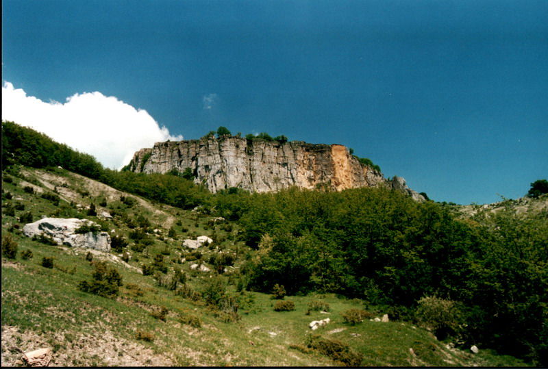 This photo and the B/W one are by Lucio Magi – 2005
Despite these “military” premises, Cosimo is not actually thinking just about defending his lands, but he wants to build on Sasso Simone an ideal city, scaring the neighbors and being impregnable, but also becoming at the same time the prototype of a geometrical and architectural perfection, plunged into nature.
The will to proceed is very strong, and the motivation eventually even increased after the first survey on Sasso Simone back in the Summer of 1554, several years before the beginning of construction, when everybody completely understood the beauty and the strategical importance of the site. Moreover in the years between 1450 and 1570 the climate in our area is particularly mild, and on the Sasso it is possible to grow barley, peas and linen, so the idea of building a city on the mountain may have seemed particularly awesome, bringing some to even talk about a City of the Sun.
Cosimo knew that before him already the Malatesta family had thought about building up there a fortress that could compete with San Leo, and that on the Sasso had lived a few Benedictine monks since the year 1000, in the abbey built on the ruins of an older Lombard church dedicated to the “same old” Saint Michael Archangel (see the article on the Byzantine Corridor).
The work goes on, after laying the first stone, very intensively for ten years, and in 1573 the first permanent garrison with ten soldiers is sent to the mountain.
The project considers to build 50 houses, a residence for the captain, a prison, a chapel, a water tank, two towers and walls all around, to host 300 people. There is also a plan to build a colonnade outside the walls, to host a fair in the summertime. The Città del Sasso was supposed to become one of the biggest (if not the biggest) communities in the area.
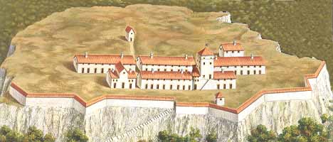 The City of the Sun from the town of Carpegna website
The administration in Florence was trying to keep the work under control, and in fact an important picture explaining what was going on on the Sasso comes from the report of the inspection made by Baccio Del Bianco and Vincenzo Viviani in 1644, sent to check whether the city was reinvigorating or if it was gradually losing its mojo. The inspectors describe three blocks, called based on the communities that had built them, with the names of Sestino, Borgo San Sepolcro and Pieve Santo Stefano, for a total of about 40 houses. Each house had a yard and in the city were living a blacksmith and a horse keeper.
The two men do not even lack practical details in their report, explaining for example that too much timber was being used, subject to deterioration, and that the heads of the beams needed to be “bronzed” to avoid collapses.
Despite the efforts and the investments the health conditions of he city did not appear to be too good. Furthermore the other cities in the area did not like to be downgraded and the people dissatisfaction against the City of the Sun did not help who wanted to invest more in the project. The years pass and the fortress cannot reach the importance that Cosimo had hoped for. It seems that even the few military expeditions in the area did not start from the Sasso Simone, making even the military role of the site seem quite useless. At the end, to make things worse, after the period of mild weather that had been so favorable in the beginning, came also what is now called the Little Ice Age, dropping the temperatures everywhere in the northern hemisphere until 1800, and forcing the few inhabitants of Città del Sasso to completely abandon the mountain in 1673, finally preventing Cosimo de Medici’s dream of an ideal city to come true.
Nowadays little remains of that dream except for the cobblestones of the road to the top, the water tank and some wall ruins.
What is still there though is the beauty and the charm of this magical place, explaining even today how it was easy to dream and imagine a City of the Sun right up there.
Lucio Magi – February 2016
This article used the following books as a reference:
“La città del Sasso” – Girolamo Allegretti 1992
“Mestieri e quartieri nella città fortezza del Sasso di Simone in una relazione del 1644” – Giancarlo Renzi 1992
For more information see the Sasso Simone and Simoncello Pçark website
http://www.parcosimone.it
and the town of Carpegna website
http://www.comune.carpegna.pu.it/conoscere-carpegna/il-sasso-simone/la-citta-del-sole/
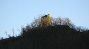
The Massa Trabaria Towers
Following the one about the Byzantine Corridor, I will continue with the series of articles dedicated to the territory of the Pesaro-Urbino Province.
Not being a professional historian or archaeologist but just a passionate self-made researcher, I will very unlikely propose original topics or writings, but I will humbly limit to re-read (and sometimes to re-discover) in a less academic way books treating local history and folklore, always with the aim to bring more people to be curious and interested in our magnificent territory, and as a consequence to contribute in protecting it in all its beauty.
My reference book is this time a short work dated 1981, “Le torri del Montefeltro e della Massa Trabaria” (The Montefeltro and Massa Trabaria towers), by Francesco Vittorio Lombardi, that will take us to deepen a bit more the knowledge of the history of the many fortresses raised in the higher Metauro river Valley.
Let’s start from the name, why Massa Trabaria?
The Massa got its name during the late Roman Empire age, and it was nothing more than a wide land property created from groups of smaller rural plots, abandoned by the owner due to the emerging agriculture crisis.
Trabaria comes from “travi”, the italian word for beams, referring to the logs since long time cut and sent down to Rome, crossing the Appenninis first and floating on the Tiber river later on, to be used for the construction of the religious buildings.
The Massa Trabaria was for this reason historically always linked to the Church and its tributes arrived directly to St. Peter’s Cathedral, and in fact this area was originally known as Massa Sancti Petri.
With the beginning of 1200 the German Emperor Otto IV recognized the region as autonomous and its extension eventually covered the today’s territories of Sant’Angelo in Vado, Mercatello sul Metauro, Sestino and Belforte all’Isauro. In this wide area were present many small rural communities, independent themselves from each other but connected to the same institution called Communis et Universitas Massae, whose inhabitants were commonly known as “massani”.
The Massa remained anyhow tied to the Roman Church and was for this reason always fighting against the neighbour Ghibellines from Montefeltro and Carpegna. It also had to defend itself from the expansive goals of Città di Castello, and the massani were forced to organize huge defensive systems. The communities strengthened the walls of the villages and erected towers, most probably in the same locations where many centuries before were the Byzantine ones, which had protected the Flaminia and Romania territories from the Goths and later from the Lombards. The new towers were raised to spot the enemies from far away, to allow the soldiers to warn with fires or horn blows the people in the villages, so that they had time to take shelter. Furthermore the towers were also a reference for all the merchants coming from Tuscany or from Rome and willing to reach the Adriatic sea, or for all the pilgrims coming from Northern Europe, who had to necessarily pass through the Massa and the Montefeltro on their way to Rome.
Despite the fortresses the Massa was not able to remain united, and during 1300 many areas became subjugated to several local powerful families (Faggiola, Brancaleoni), until they again joined the Papal State thanks to Cardinal Albornoz, during his “reconquista” mandate from Pope Innocenzo VI.
Unfortunately the new split that stroke the Church in 1378 brought back chaos in Italy and in all the Church lands, and the territory was in the end partitioned by valley among the local families and the Church itself, causing with time the loss even in the common memory of the identity of the Massa Trabaria and its towers, some of which crumbled while the others were worn out by time, wars and earthquakes.
Today only some of those stone guardians are still there. The most important are the tower of Montemajo, the tower of Metola, Castello della Pieve, the tower of S. Martino (the only cylindrical one), the tower of S. Andrea, the tower of Castel de’ Fabbri and the towers of Parchiule.
Lucio Magi – January 2016
[mapsmarker layer=”1″]
Also you can find more information visiting the following website
http://www.turismoborgopace.it/la-massa-trabaria-torri-e-castelli/

Indra Treks 2016
The official Treks Schedule for January-June 2016 is ready and can be reviewed here.
More details will follow in the next weeks (itinerary, difficulty, lenght, etc.)
To make easier the interaction with whoever would like to join our treks we have opened a Facebook webpage that will be the official channel for all “quick” communications, leaving any other detail to this web site.
The opening will be on January 31st 2016 with a new trail at Alpe della Luna.
IndraTrek, the origin of an idea
Here I am, ten years after the birth of the Indra Trek & Travel project, to remind (maybe above all to myself…) what is behind this idea and its name, probably a bit too exotic and obscure for many, but so fascinating and important to me.
I had just returned home after a few years living abroad and I had brought back many pictures and experiences to tell. Once settled in my home country and continuing to travel for work and for pleasure I started methodically and passionately as never before to explore every corner I could in the land I was born, finding in my hands in a very short time a lot of material which I thought it was a shame to leave hidden in a drawer. Besides getting mad to scan (often with awful results) all the analog photos I had started writing during my travel experiences and the treks, in the beginning just to document and describe what I saw and to find a way to freeze the memories better and then, after overcoming the initial insecurity, converting the individual drive in desire to share, with the ambition and the hope to use one day all such material as a preparation and foundation for a real life change.
The eternal passion for travelling and the always great and inexplicable attraction towards the East, which in the previous years despite my many tries life had always continued to keep far away and finally was now becoming concrete after a few trips on the field, together with the love for the mountains and the achieved awareness of the beauty of my home land, pushed me to research some kind of leading thread joining all together. My hope was to build a bridge, I still cannot really explain why, between far and near.
Maybe I was moved without knowing from what one of the greatest Orientalists of all times, Giuseppe Tucci from Macerata, referring to himself and to other great and old “knowers” of the East from the Marche Region (Matteo Ricci in 1500 and the Fransciscan Mission in Tibet in 1700), calls “This inexplicable attraction between the Marche and the East“, but it is a fact that I started full of doubts which partially I still bring with me today to lay cables and build pillars for my project, but this first of all needed the proper name.
At that time my main goal was to publish material for trekking and the word Trek was almost mandatory, but I found out that besides recalling hikes in the mountains it also owned a deeper meaning. This term comes from far away and has arrived to us transformed in its sense compared to the primitive meaning given by the South African Boers and deriving in turn from the Dutch. In Afrikaans in fact trek can be translated with “slow trip taken on ox wagon”, and in South Africa in 1800 one trek was equivalent to one day travelling on ox wagon, substituting by fact the mile as the measure unit for distance. This word acquired to me the meaning of moving on a slow path, sometimes even hard and demanding, where you can enjoy the itinerary with no rush or competition, and for what concerns myself this is also the only way to conceive any kind of trip, since always. This calm-tempered travelling and trekking is what I believe links better than anything to my own lands and the Marche region they belong to, since for culture and territory they lead themselves maybe better than any other to be traveled slowly.
After resolving the concept of near I was left with the problem of the bridge, how to connect local treks with travelling and with the beloved Orient. I needed another word, a symbol or something similar that put together with Trek could take one’s imagination far away and could create the dichotomy I was looking for.
It was not an easy matter, many terms and ideas were wandering through my head without being able to find the right one until my father came to my help, giving me as a present the famous and last book from Tiziano Terzani, “One More Ride on the Merry-go-round“.
At the end of a beautiful chapter dedicated to travel and to the meaning of a potential renounce for who made of it its entire life is quoted a passage from the Aitareya Brahmana.
The Brahmana are sanskrit books from Ancient India explaining the rituals of the even more ancient Vedas, and specifically the Aitareya Brahmana explains one of them, the Rig Veda.
In the passage on the book from Terzani the God Indra, the king of the Vedic deities to whom are dedicated in the Rig Veda a huge amount of hymns and who is also the protector of all travellers, encourages a young character, Rohita, to leave the society and travel:
There is no happiness for him who does not travel, Rohita!
Thus we have heard.
Living in the society of men, the best man becomes a sinner… therefore, wander!
The fortune of him who is sitting, sits;
it rises when he rises;
it sleeps when he sleeps;
it moves when he moves.
Therefore, wander!
I had found the connection, the two words put together were working to me, and so from that day IndraTrek became synonym for far and near, and also the symbol of my bridge.
I created the website indratrek.it and started publishing short travelling stories and photos, plus the reports of my treks on many trails with as many details as possible of all passages and even drawing the maps (all handmade except for some raw experiments to interface with Google Maps, not even too developed at the time), trying to create something complete and harmonious.
Unfortunately the project never took off completely as the passions behind it deserved, maybe for lack of courage and fear of leaving the known road, or maybe just because times have never been mature so far. With time and new commitments arriving the site has even been a bit abandoned and more than once I thought about dropping everything because it was not worth publishing stuff that at the end of the day has very small visibility and is helpful just to a few users, especially because in the meantime many other websites were born, much more specialized and updated in their contents.
Despite all of this all the old content is still firmly and nostalgically there, now together with the new Blog and pages to bring nourishment to the idea, still waiting for the right time to come…
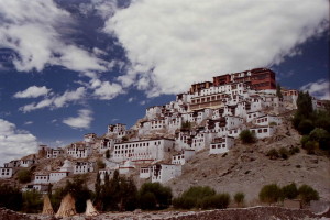
Maitreya Tours – Ladakh Himalaya
MAITREYA TOURS, our reference tour operator in Ladakh, has published the new program for 2016.
Our dear friend Dorjey Daya, owner of the agency, has gathered together on its site http://www.ladakhhimalaya.com/ (or on http://www.spiritualhimalaya.com) a rich collection of very different proposals.
We start with the Snow Leopard expeditions. Until the end of February it is possible to join a 12 days tour (including the first 2 for acclimatization in Leh and the next 10 days camping) allowing to spot the very rare feline in the Hemis National Park or in one of the other possible areas depending on its wanderings.
Link Leopard

Also in February (14th to 24th) it will be possible to attend two festivals in Ladakh, having Oracles in the leading roles.
In the first festival, the Stok Guru Tsechu, the oracles are chosen among the men of the Stok village and, after being trained by the monks of the Spituk monastery, they linger among the watchers during the two days of celebration, performing blindfolded acrobatic dances and answering questions about the future.
The second festival is the Matho Nagrang, where the oracles are monks from the Matho monastery, they are chosen with a ballot and they stay “in charge” for four years.
Link Oracles
A beautiful trip in less famous regions in Northern India on the Pakistan borders is the one proposed with the Trans-Himalaya tour, where from Delhi you will travel first to Amristar, capital of the Sikh and location of their Golden Temple, and then you continue to Dharamshala, residence of the exiled Dalai Lama. From here we pass through the remote regions of Lahual and Spiti before crossing the western part of the Himalaya Range and reach Leh.
Link Trans-Himalaya
By the beautiful lakes of Tsokar and Tsomoriri in summertime it is possible to do bird-watching and spot some rare birds like the Black Necked Crane in a 10 days tour.
Link bird-watching
Besides all of the above Maitreya is offering of course the core of its offer, with the trekkings (link Trekking) with possible homestays where the itinerary allows it, and the classic Ladakh and Zanskar tours (link Tour) with all their natural and cultural beauty.
Mr. Daya is also now owner of a Guesthouse with six doubles to accomodate the guests in Leh.
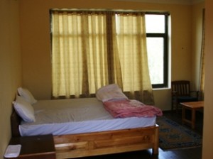
See here all the details on the location and other information and photos, and all the other possibilities for homestays either in the most famous sites and in remote villages.
For whoever would like to have some more information on Ladakh it could be interesting see the photos published (a few years ago ..) on the original Indratrek website (link Indratrek).
Julè Julè!
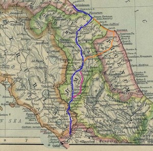
The Byzantine Corridor
Travelling in the Byzantine Corridor, the idea for a Trail
Wandering around some of the most hidden corners in the Province of Pesaro-Urbino on the border with Umbria you may very likely happen to enter, without even knowing most of the times, a territory that starting from the second half of the VI century AD and until the end of the Lombards dominion was the only passage capable to connect the two main power centers in Italy within the relics of the dismembered Western Roman Empire.
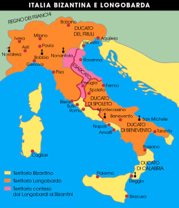
We are talking about the Byzantine Corridor, a land strip running through Marche, Umbria and Lazio and linking Ravenna with Rome. The ancient Flaminia Road, preferred way of communication in the earlier centuries, was now interrupted since the narrow Furlo Pass, gateway along the artery connecting Rimini with the old Imperial Capitol, was now under the Lombards control. It was hence absolutely fundamental to find an alternative route to connect the Exarchate in Ravenna and the Pentapolis (a city union including Rimini, Pesaro, Fano, Senigallia and Ancona) with Rome and for this reason the Corridor was passing through many impervious regions, mostly in the mountains and therefore well defendable, where the Lombards could not yet reach.
The Byzantine Corridor
The Lombards invaded Italy in 568 AD, after the war against the Goths to regain the territories once belonging to the Western Roman Empire had exhausted the Byzantines. For this reason and due to the fact that the best troops were called back to Byzantium and to Asia to fight against the Avars and the Persians, the submission of a good part of the Peninsula was quite easy for the Lombards.
The Byzantines were able to keep under their dominion a few areas among which were the Exarchate and the Pentapolis, as well as the majority of Lazio and Southern Italy, but the Lombards were indeed extending their influence to the Center and the South with the Duchies of Spoleto and Benevento, and the Continental Italy was in fact broken in two separate areas with no connection in between, except for the Byzantine Corridor.
In such a borderland like the Corridor was, as one can imagine, was living a variety of peoples and cultures either of local origin or foreigners arrived with the barbarian ords, all with their traditions and, above all, with their Gods and Patron Saints.
Christianity had already spread everywhere, after being equalized to the other religions by Costantino and especially after becoming the only Empire official religion with Teodosio in 380 AD, but in the remoteness of the Corridor many still followed Paganism, as shown by plenty of examples of churches built in this area on top of Altars originally erected to venerate Jupiter or Apollo.
The Lombards were originally worshipping (as many other peoples coming from the North) Ases like Thor and Odin, and they approached Catholicism just for convenience way before their descent in Italy, when they had to ingratiate precisely the Byzantines, their allies during the stay in Pannonia (current Hungary).
The decision to invade the Peninsula changed things around, and the Lombard king Alboino commanded, in order to irritate the Byzantines, to join in stead one of the Heresies officially condemned by the Council of Nicea, Arianism, which had dared to deny the Trinity and put Christ on a lower level compared to the Father, and which was by cohincidence also the Religion of his main potential allies against Ravenna, the Goths, who were still present in the territory despite their previous defeat.
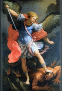
Once in Italy the Lombards merged more and more with the local population, and eventually massively converted to Catholicism. During this process of conversion they ended up adopting as Patron Saints the ones that maybe resembled more their ancient Gods and among them one of the most important was certainly Saint Michael Archangel, who had abandoned Satan in the Christian tradition and defended the True Faith with his sword, in whom the Lombards were recognizing most probably the God Odin.
Even the Byzantines, the Lombards’ rivals, had their own Patron Saints and were particularly devoted to Saint Martin of Tours, protector of the Catholic faith from all heresies, and especially from Arianism, against which he had personally fought. To prove the importance of this Saint the current Basilica of St. Apollinare Nuovo in Ravenna, raised as Arian Church when the Goths conquered the city, was dedicated indeed to Saint Martin after the Byzantines took it back.
Based on this historical premise, the authors of a recent research made in cooperation with the University of Urbino demonstrate that it is possible to locate the borders of the Byzantine Corridor analysing the toponyms of the sites and of the religious buildings present on the territory. As an example many are the cases of churches consacrated and sites referenced to St. Michael Archangel to testify the Lombard dominion, as well as clearly all the ones dedicated to St. Martin must be linked to the Byzantines. In some cases we even have two rival Saints facing each other in churches built on the opposite sides of a valley or a river, just like they were the real generals leading the two opposing armies.
St. Michael Archangel painted by Guido Reni
From the results of this work we can then try to sketch a travelling itinerary that, following the tracks identified by the historians, takes us to discover a portion of the Byzantine Corridor in the Province of Pesaro-Urbino and that jumping from Byzantine to Lombard possessions leads us from the border with Umbria, following the main rivers, to the Furlo Gorge and then to reach the Adriatic Sea.
The territory where we will travel is mostly mountaineous and bumpy, close to the North West limit of two mountain ranges running parallel to the coast, the Umbrian-Marquesan range and the proper Marquesan one. The first developes on the border bewteeen the two regions and includes Mount Catria, Nerone and Petrano, while the mountains forming the Furlo Gorge (Pietralata and Paganuccio) belong to the Marquesan range.
The main rivers in the area flow perpendicularly to the ranges, creating at times narrow canyons and at times wider valleys. The Burano river, the first we will meet along our trail, starts in Umbria and from here, after crossing the first of the two ranges, arrives in the city of Cagli. Continuing its flowing to the sea it becomes tributary of another river, the Candigliano, also coming from Umbria, which after cutting like a razor the anticline of the second range and creating the Furlo Gorge, drops into the more famous Metauro river.
The Flaminia Road
Let’s start then from Pontericcioli, right on the Burano river on the border of the Province, that was once an ancient Umbrian city later conquered by the Romans and that became with time an important center along the Flaminia Road. Pontericcioli can be reached from Fano via the freeway to Fossombrone and Cagli, or from Gubbio and Scheggia if you are travelling on the old Flaminia Road from Rome. Nowadays it is a small town famous for its Roman bridge Ponte Grosso and for its possible identification with the Roman municipality of Luceoli dated I century BC. Here already we can see by studying the toponymy that the high Burano valley was under the control of Ravenna, and we can tell just because we have references to another important figure connected to the Byzantines, St. Apollinare, who is said being direct disciple of Saint Peter and first Bishop of Ravenna.
Over Mount Petria, just in front of the more renowed Catria and dividing Pontericcioli from the community of Chiaserna, things were quite different. Here in fact both the church of St. Anastasia right in the village centre (Anastasia can be connected to the typical Gothic ritual of the Resurrection or Anastasis) and the Abbey of St. Angelo, in the surroundings of Chiaserna along the Bevano stream, speak very clearly in saying that the valley was populated by people of Barbarian origin.
Continuing North we reach the little town of Cantiano, right on the crossroads between the “Byzantine way” along the Burano valley and the “Lombard way” from Chiaserna, and from here we continue to the village of Moria, scrambled on the South West side of Mount Petrano, where we find another church dedicated to St. Apollinare. Not too far, between the two small villages of Caimarini and Caimercati, we also have a site still known today as Hill of St. Martin and both the toponyms make us understand that the Corridor was going right through this area. Mount Petrano had been in fact massively fortified by the Byzantines, even if today we have very little remainings of this powerful defensive system protecting the Flaminia Road and Luceoli.
Looking again to the North, on the opposite side of another tributary of the Burano, the Bosso (famous for its canyon and the open-air geological museum), we have another important massif in the area, Mount Nerone, which was strongly guarded by the Lombard troops as demonstrated by the two churches consacrated to St. Michael Archangel in Cerreto and Fosto. The first is a small community reachable from the village of Pianello, while the second is also a small village but on the road connecting Secchiano to Piobbico. Mount Nerone seems to have been much less militarized with towers and castles than Mount Petrano, and this could very well be explained with the simple fact that the Lombards were outnumbering the Byzantines and did not need to control a very narrow crossing among enemy lines as their rivals were forced to do.
But let’s leave again the Lombard zone to continue along our Corridor Trail, which from Moria takes us to the top of Mount Petrano and then, following its gentle profile and crossing its grazings, goes down to the opposite side of the mountain just near Cagli.
This important town was a huge stronghold for the Byzantine defense but is crowded with references to the Lombards. We find again here, besides the “same old” St. Michael Archangel (oddly becoming also part of the town’s emblem after it was rebuilt and re-baptized St. Angel Papal from Pope Niccolò VI at the end of 1200), also mentions to other figures dear to the Lombards, like Saint Savin. The Bosso narrow valley was also interdicted to the Byzantines, as shown by the name of the local Staffolino Bridge (coming from the German word “staffal”, meaning pole), as well as there was no way out from the canyon between Mount Petrano and Tenetra. It looks like Cagli was completely surrounded by the Lombards and it is very difficult here to find a crossing in between enemy lines. But following the by-now-friends toponyms, the historians were able to reveal a passage coming down from Mount Petrano directly on the Flaminia Road just outside town. From here you could wade across the Burano on the right bank and then, further down near the other village of Smirra, cross again on the opposite side bypassing the enemy troops around Cagli.
The way was then continuing to another important stronghold now destroyed but appearing in many proofs, the Castrum (castle) of St. Martin, protecting the way towards Fermignano, another important town in the Metauro Valley. After eluding the Furlo Pass it was finally possible to enter the more secure and far from the border land of Montefeltro, to reach Urbino and then Rimini.
This was not the only safe itinerary for the travellers though. The toponyms studies lead us to think there were other crossings between the Lombard armies and that more branches of the Corridor were used at the same time. Going back to the beginning of our trip for instance, in the valley of Cantiano, there are clear tracks of a passage from Pieve St. Crescentino near Balbano (built back in the beginning of Christianity and famous for its important frescoes) to another important center in the area, Apecchio, eluding the Lombard troops on Mount Nerone.
Further down towards the coast, just after the Furlo Pass, if you wanted to travel to the closest member of the Pentapolis, Fano, you needed to divert to where now are the villages of Calmazzo and Canavaccio, and then continue along the Flaminia Road until Fanum Fortunae. It is quite interesting to note that in the area of Calmazzo we find track of a possible demilitarized zone, identified near St. Bartolomeo di Gaifa (Gaifa comes from the lombard word waifa, meaning “land that does not belong to anyone”), where most probably for common interest or agreement between the two parties there was no fighting taking place.
In times of more and more developement of slow tourism and with the growing of the number of new itineraries, I think that the design of a multi-stage trail along the Byzantine Corridor could be a very stimulating idea to put into practice.
Obviously we are talking about the idea of a quite different itinerary than the ones proposed along the Sacred Ways and born often after the Camino de Santiago “master” concept, but I think this would not make the trip certainly less fascinating.
We are not dealing with a hike on a Pilgrimage way but we are thinking of an itinerary crossing an ancient area where for centuries troops and civilians inevitably walked due to war, leaving proofs, building fortresses and villages, and modifying permanently the local culture and traditions, and in this perspective it could only offer a potential traveller willing to walk it today a countless number of experiences, historical and religious, cultural and artistic, naturalistic and environmental.
Furthermore we should not forget, always thinking about an hypothetical slow trip in this fantastic territory within the Province of Pesaro-Urbino (I know I am biased..) the “enemy lands” occupied by the Lombards, that are not less meaningful compared to the Byzantine ones and deserve certainly interesting detours and follow-ups.
What once was the most dangerous Furlo Pass is now included into a State Natural Reserve, with all its beauty and richness that would alone deserve the trip, while the fearsome Lombard bastions of Mount Nerone are now regularly occupied by trekkers, bikers and climbers.
For the moment being anyhow the Byzantine Corridor Trail remains just an idea and it is possible to travel along the itinerary just following the toponyms and not the signs. We can only try to stimulate the curiosity and the adventurous spirit of people willing to follow the footsteps of a traveller in the VII century AD, trying to reach the Adriatic sea from Rome or viceversa. The main purpose is though to be able to develop the idea in the near future beginning, why not, from publishing new articles with all the stages of this potential Trail narrated in all their details.
For who wants to get deeper (and can read Italian..) with the historical, geographical and toponymy contents in the Byzantine Corridor and in the territory crossed in the Province of Pesaro and Urbino it is mandatory to read the book that inspired this article, and from where I borrowed all the toponymy information. “Il Corridoio Bizantino al confine tra Marche e Umbria” was published in 2014 and is the result of the meticulous and passionate research made by the authors Giuseppe Dromedari, Gabriele Presciutti e Maurizio Presciutti, to whom goes a very special thanks.
Lucio Magi – October 2015

